Field index ↓
Voyage abstract
A common seaman’s changing-ship circuit becomes a field record others could use.
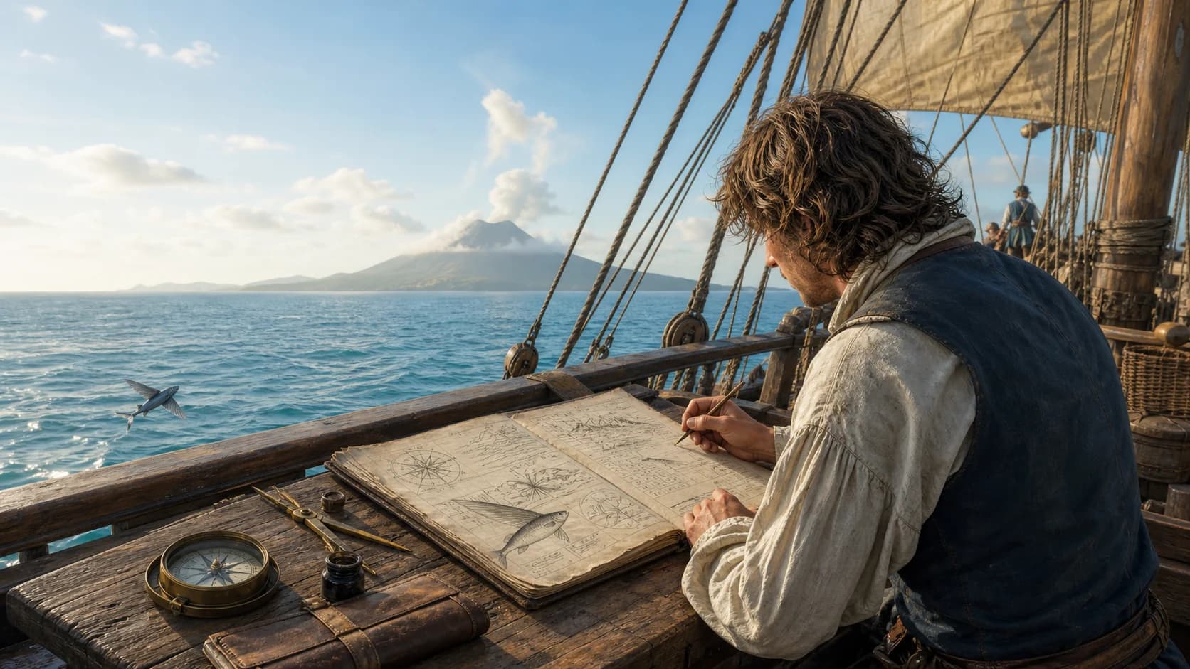
A New Voyage Round the World is William Dampier’s account of travels made between 1679 and 1691, first published in 1697. It begins among buccaneers in the Caribbean and at the Darién crossing, then runs by Cape Horn, Juan Fernández, the Galápagos, Mexico, Guam, Mindanao, New Holland, the Nicobars, Sumatra, the Cape, and England. Several ships, captains, overland crossings, and compressed intervals join the route advertised as a voyage around the world. Dampier embeds latitude, winds, currents, tides, water, coasts, vessels, plants, animals, and markets in a continuous story. Those observations served survival, raiding, trade, and future navigation at once. British Library manuscript Sloane MS 3236 preserves partly autograph text and revisions, showing how notes became a bestselling book. Its descriptions of Galápagos tortoises, Chamorro flying proas, monsoons, and northwestern Australia remained influential. Its contemptuous descriptions of peoples, its calculation of living resources, and its account of Jeoly as property likewise expose the union of knowledge, violence, and imperial expansion.
Original passages
Six passages move from observables to provisions, engineering, maps, and possession.
- OBS. 01MethodTo the Reader
For which reason my chief care has been to be as particular as was consistent with my intended brevity in setting down such observables as I met with.
Plain readingDampier’s stated priority was to record the observable things he encountered as specifically as a concise book allowed.
‘Observables’ names the method: places, weather, products, and vessel design become particulars another reader can use. - OBS. 02Island provisionsChapter V · Galápagos
The land-turtle are here so numerous that 5 or 600 men might subsist on them alone for several months without any other sort of provision.
Plain readingThe islands’ giant tortoises are measured as provisions capable of feeding a large company for months.
Natural history and logistical calculation share one sentence. Meat, oil, and survival aboard ship determine the animals’ value. - OBS. 03Local engineeringChapter X · Guam
I have been the more particular in describing these boats because I do believe they sail the best of any boats in the world.
Plain readingDampier describes the proas in detail because he judges them the finest-sailing boats in the world.
The narrow hull, outrigger, reversible ends, and shifting sail lead to a technical appraisal of Chamorro maritime engineering. - OBS. 04Monsoon weatherChapter XII · Mindanao
The west winds always bring rain, tornadoes, and very tempestuous weather.
Plain readingWesterly winds arrive with rain, squalls, and severe weather.
Wind direction, rainfall, swollen rivers, and sailing season form one environmental cycle, later developed in Dampier’s Discourse of Winds. - OBS. 05A map problemChapter XVII · New Holland
New Holland is a very large tract of land. It is not yet determined whether it is an island or a main continent.
Plain readingNew Holland’s continental status remained an open geographical question in the late seventeenth century.
Dampier follows the sentence with route-based reasoning that separates the land from Asia, Africa, and America. - OBS. 06Possession and displayChapter XVI · Jeoly
he would give me the half share of the two painted people, and leave them in my possession and at my disposal.
Plain readingDampier records receiving a half share in two tattooed people and the power to possess and dispose of them.
The property language is explicit. Dampier later brought Jeoly to England for exhibition; Jeoly died of smallpox in 1692.
Track × notes × print
Twelve years of movement and three decades of editions establish the book’s coordinates.
- 01
England to Jamaica
Dampier sailed in the Loyal Merchant. Plantation work, coastal trading, and short employment soon drew him into Caribbean buccaneering networks.
- 02
Across the Isthmus of Darién
The company crossed from the Caribbean to the Pacific, seized and exchanged vessels, and operated around Panama.
- 03
Return to Virginia
The first Pacific phase ended. Dampier then joined John Cook’s company for a new westward voyage from Chesapeake Bay.
- 04
Cape Horn to the Galápagos
The company entered the South Pacific and worked north along the American coast. Islands appear as combinations of water, food, anchorages, and raiding positions.
- 05
Mexico to Guam
The ship left Cape Corrientes on 31 March, used the trade winds across the Pacific, and reached Guam roughly two months later.
- 06
Mindanao
Dampier recorded monsoons, rivers, markets, political relations, and crew conflict at unusual density before the Cygnet sailed west.
- 07
Northwestern New Holland
The Cygnet stopped for repairs on the coast now associated with the Kimberley region of Western Australia. Dampier observed tides, shores, species, and inhabitants.
- 08
Escape from the Cygnet
At the Nicobars, Dampier and several companions left the ship and crossed the Bay of Bengal to Aceh in a local vessel.
- 09
Years compressed in the narrative
Experiences around Sumatra, the Gulf of Tonkin, and the Straits of Melaka are summarized or reserved for later work, sharply accelerating the first volume.
- 10
Return to England
Via Bencoolen, the Cape, and St Helena, Dampier reached the Downs on 16 September and closed the circuit narrated in the book.
- 11
A New Voyage published
The first edition sold quickly and a second appeared in the same year, turning a common seaman and buccaneer into a prominent travel writer.
- 12
Second volume and Discourse of Winds
The companion volume included Campeachy experiences, a supplement, and a systematic account of tropical winds, storms, seasons, and tides.
- 13
Corrected seventh edition
A New Voyage entered a collected edition of Dampier’s travels. A widely used searchable text follows this edition.
Twenty-chapter fieldbook
Four signatures of five chapters run from Darién to the Pacific, Asia, New Holland, and home.
SIGNATURE 01
Caribbean to the South Pacific
Darién, an Atlantic return, Cape Horn, and the Galápagos form a route of crossings and restarts.- 01
Chapter I · South Sea company
Jamaica, Darién Bay, and the company
- 02
Chapter II · Across Darién
Overland travel, canoes, and Panama Bay
- 03
Chapter III · Back to the West Indies
Changing ships, dividing companies, and Virginia
- 04
Chapter IV · Westward again
Cape Verde, Sierra Leone, Cape Horn, Juan Fernández
- 05
Chapter V · The Galápagos
Tortoises, iguanas, water, and a buccaneer base
SIGNATURE 02
Pacific America and the ocean crossing
Operations from Peru to Mexico lead into a trade-wind passage to Guam.- 06
Chapter VI · Pacific South America
Peruvian and Ecuadorian shores, towns, islands, anchorages
- 07
Chapter VII · Panama Bay
Tides, harbours, and Spanish shipping
- 08
Chapter VIII · Central American coast
Raids, provisions, and divisions in the company
- 09
Chapter IX · Mexico
Cape Corrientes and preparation for the crossing
- 10
Chapter X · Pacific and Guam
Trade winds, latitude, and Chamorro proas
SIGNATURE 03
Philippines and Southeast Asian seas
A long Mindanao stay gives monsoon, politics, markets, and shipboard life exceptional space.- 11
Chapter XI · Arrival at Mindanao
Harbour, rulers, food, and first exchanges
- 12
Chapter XII · Mindanao monsoon
Westerlies, squalls, rivers, and town life
- 13
Chapter XIII · The island and the crew
Trade, sociability, disagreement, and departure
- 14
Chapter XIV · Pulo Condore
Southern Vietnamese waters, watering places, and sea conditions
- 15
Chapter XV · Edge of the China Sea
Island routes, storms, and course decisions
SIGNATURE 04
New Holland, Indian Ocean, and return
A typhoon, the New Holland coast, the Nicobar departure, and Sumatra finally join the homeward Cape route.- 16
Chapter XVI · Bashi channel
Typhoon, island trade, and Jeoly
- 17
Chapter XVII · New Holland
Northwest coast, tides, repairs, and inhabitants
- 18
Chapter XVIII · Nicobars and Aceh
Leaving ship, open-water canoe passage, and illness
- 19
Chapter XIX · Sumatra
Aceh, Bencoolen, and the English factory
- 20
Chapter XX · England
Cape of Good Hope, St Helena, and the Downs
Route construction
Changing ships, captains, overland crossings, and departures determine the circuit.
Dampier possessed no twelve-year circumnavigation plan when he sailed in 1679. Making a living in Jamaica, joining a buccaneer company, crossing Darién, taking vessels in the Pacific, returning to Virginia, and sailing again with John Cook produced a route of repeated turns. After Cook died, Edward Davis and Charles Swan led successive companies; Dampier later left Swan’s Cygnet.
The phrase ‘round the world’ therefore names a personal line of movement. Ships and companies relay the traveller, sea and land passages join, and three years contract into summary. Harbours, divisions, and ship changes turn the chapters; command and provisions explain the course more fully than a projected itinerary.
This structure creates a distinctive point of view. Dampier alternates between common sailor, participant in councils, and recorder of captains’ choices. He lacks the continuous authority of a captain’s official journal yet stands close to deck work, hunger, fever, and crew disagreement.
Observation system
Dates, latitude, wind, current, water, and species form a working record carried at sea.
Dampier repeatedly gives latitude, bearing, shore profile, depth, tidal range, wind, and weather. On reaching an island he commonly inventories anchorage, fresh water, timber, food, and exchange. Animals and plants enter by appearance, habitat, taste, keeping qualities, and use aboard ship.
A whole ship helped produce this knowledge. Helmsmen, pilots, Indigenous guides, captives, merchants, and other buccaneers supplied positions, names, and practice; captured Spanish charts and papers also informed decisions. Dampier’s observational skill is conspicuous, while the sources remain collaborative and frequently coercive.
British Library Sloane MS 3236 preserves partly autograph writing for voyages of 1681–1691 and corrections in Dampier’s hand; a section by Lionel Wafer also sits inside it. Reading manuscript and print together reveals selection, supplementation, and rearrangement on the way to the coherent book of 1697.
Environmental calendar
Wind joins weather, speed, rivers, and departure dates in one table.
The Mexico–Guam crossing shows the northeast trade wind sustaining an ocean passage. Mindanao’s westerlies arrive with rain, squalls, and swollen rivers. Wind acts as a temporal force that changes food, illness, exchange, and the decision to stay or leave.
Dampier compares wind belts across latitudes and notes cloud forms, signs before a squall, and displacement by current. Repeated journeys turn episodes into regional patterns, so a reader can place one storm within a seasonal cycle.
The 1699 Discourse of Winds reorganized observations like these by topic. In the 1697 volume its raw material remains inside the story: a crossing, storm, or delay is also a unit of environmental knowledge.
Resources and provisions
Galápagos natural history measures tortoises by the number of people they could sustain.
Dampier distinguishes sea turtles from land tortoises and records size, oil, nesting, and capture. His estimate that they could feed five or six hundred people for months is vivid observation entered directly in a fleet’s provision account. Scarce water, abundant food, and concealment made the islands a place for buccaneers to recover and plan attacks.
The descriptions stimulated later natural-history interest, but they emerged amid intensive capture. Tortoises survived aboard ship and their oil kept; island animals became portable energy for an ocean passage. Abundance, taste, and storage determined their textual prominence.
The Galápagos chapter holds the book’s characteristic double vision. Its particulars help identify species and habitat while directing a company toward exploitable supplies. Ecological history and buccaneer logistics use the same evidence.
Local engineering
The speed of Guam’s flying proas resets the European observer’s measure of a good boat.
Dampier describes the Chamorro proa’s narrow hull, windward outrigger, asymmetric sail, and method of reversing. Bow and stern exchange functions as the crew shifts the yard and steers from the other end, avoiding a turn and keeping speed on a reach.
His judgment that these are the world’s best-sailing boats follows their motion: acceleration, reversal, and balance. The chapter preserves an accomplished maritime engineering tradition outside European ship design.
The proas also belong to Guam after colonial war. Spanish rule, missionization, and violence had already transformed Chamorro population and maritime life. The technology described in English sits within that history rather than outside time.
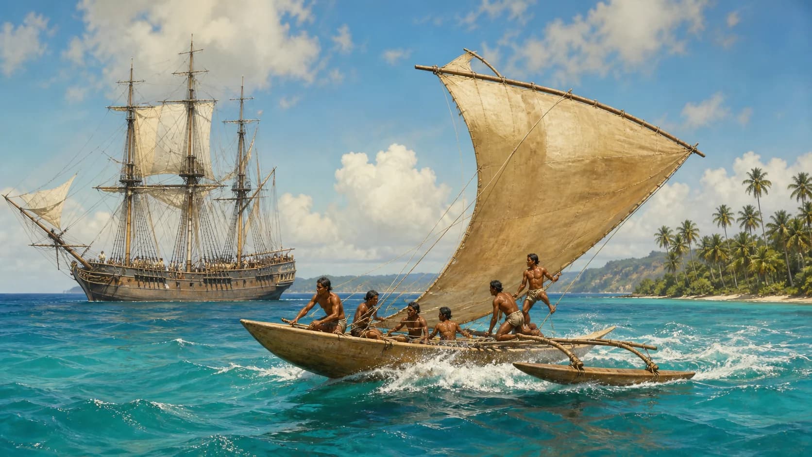
Narrow hull, windward outrigger, and a reversible rig produce speed; Dampier’s prose preserves a technical admiration for Chamorro boatbuilding.
Knowledge and possession
The New Holland coast and Jeoly’s life place observation inside structures of possession.
In 1688 the Cygnet repaired on the northwestern coast of New Holland. Dampier recorded tides, low shores, fish, birds, and plants and described inhabitants through a brutal hierarchy. The first layer entered British mapping and natural history; the second supported colonial ideas that ranked lands and peoples. Dutch voyages had already accumulated coastal knowledge, while this visit became an early, widely circulated English account.
Jeoly, a tattooed man from the Philippine region, and his mother were bought and transferred. Dampier accepted a half share in them and brought Jeoly to England. London promotion turned his body into an exotic spectacle; Jeoly died of smallpox at Oxford in 1692. The chain runs from Asian warfare and enslavement to a European exhibition market.
The success of the 1697 book carried winds, routes, species, and local technologies from a buccaneer voyage to merchants, naturalists, and naval readers. Dampier later received command of a voyage to New Holland. Observation produced authority and converted a history of predation, coercion, and vulnerable lives into knowledge capital for British action overseas.
Evidence layers
Observational density, manuscript revision, companion accounts, and local histories provide four coordinates.
Weather, coasts, vessels, and provisions
Dates, latitude, wind, tides, water, species, and vessel handling form a comparable observational layer and the book’s most durable contribution.
The narrative was arranged and revised
Autograph pages, marginal corrections, and Wafer’s section in Sloane MS 3236 reveal relations among field record, collaborators’ material, and print editing.
Buccaneer actions and decisions
Accounts by Basil Ringrose, Lionel Wafer, William Cowley, and others provide parallel views of divisions, attacks, dates, and places.
Chamorro, Mindanao, Aboriginal, Nicobar, and Jeoly histories
Local scholarship, oral history, and colonial archives restore names, political relations, war, and continuity compressed by the English narrator.
Reading editions
Modern annotation, searchable wording, first-edition pages, and the weather sequel serve different uses.
Penguin Classics · introduced by Nicholas Thomas
A 304-page modern-spelling edition whose introduction connects natural observation, buccaneering, and early British empire. A strong entry for continuous reading and teaching.
Argonaut Press · N. M. Penzer and Albert Gray
An edited early-text tradition with bibliographical matter. Gutenberg Australia provides searchable wording derived from this line.
James Knapton first-edition facsimile
Page images preserve title, spelling, paragraphs, and the original printed object. Internet Archive and Wikimedia Commons provide page-by-page access.
Voyages and Descriptions · companion volume and Discourse of Winds
Campeachy experiences, a supplement, and the meteorological treatise form another volume. Cite it separately while reading it beside the 1697 voyage.
Reader questions
Buccaneering, changing ships, natural history, Australia, manuscript, and Jeoly.
What is A New Voyage Round the World about?+
It follows Dampier’s movement from 1679 to 1691: Caribbean and Darién buccaneering, Pacific America, Guam, Mindanao, New Holland, the Nicobars, Sumatra, and the return to England. Winds, currents, latitude, provisions, local vessels, species, and port societies run through its twenty chapters.
Was William Dampier a pirate or an explorer?+
His early circuit took place mainly in buccaneering companies that seized ships, attacked Spanish settlements, and took cargo. He also developed exact nautical and natural observation, and after publishing successfully received a Royal Navy command. Both roles shaped the same career.
Did one ship complete the voyage?+
Dampier’s personal circuit used many vessels and overland stages. He crossed Darién, returned to Virginia before sailing west again, changed captains, and left the Cygnet at the Nicobars. The title gathers the author’s movement around the globe.
Why does the book matter to natural history?+
Dampier describes plants and animals by form, habitat, taste, preservation, and use, tying observations to place, latitude, and season. Galápagos tortoises, New Holland species, and tropical plants thereby became locatable and comparable records.
Is the Discourse of Winds part of the 1697 first edition?+
The systematic Discourse of Trade-Winds, Breezes, Storms, Seasons, and Tides appeared in the 1699 companion volume. The 1697 voyage contains abundant weather observations that supplied its experiential foundation.
Was Dampier the first English visitor to Australia?+
He is commonly identified as the first English visitor to leave and widely publish a record, after reaching the northwest coast in 1688. Dutch mariners had already charted and named parts of the coast, and Aboriginal societies possessed tens of thousands of years of local history.
Does Dampier’s manuscript survive?+
British Library Sloane MS 3236 covers South Sea voyages of 1681–1691. Parts are autograph and carry corrections by Dampier; it also contains writing by Lionel Wafer. The volume is central to studying how the printed narrative formed.
Who was Jeoly?+
Jeoly was a tattooed man from the Philippine region displaced and traded around 1690. Dampier became a co-owner and brought him to England for exhibition. Jeoly died of smallpox in 1692, and his history exposes enslavement and spectacle behind the travel book.
Research sources
Full text, first edition, manuscript, book history, and individual lives
- 01A New Voyage Round the World · 1729 searchable text ↗
Project Gutenberg Australia
Searchable text of all twenty chapters, the cited passages, and edition prefatory matter - 02A New Voyage Round the World · 1697 first edition ↗
Internet Archive / Wikimedia Commons
Page images of the first edition and its material setting - 03Sloane MS 3236 ↗
British Library Archives and Manuscripts Catalogue
Catalogue record for the 1681–1691 voyage manuscript, autograph ranges, and Lionel Wafer section - 04A New Voyage Round the World · Nicholas Thomas edition ↗
Penguin Classics
Edition details for the 2020 annotated reading text - 05Dampier, William (1651–1715) ↗
Australian Dictionary of Biography
Biography, publication history, companion volumes, and New Holland voyage - 06William Dampier: Pirate Who Collected Plants ↗
Smithsonian Ocean
Overview of wind, current, latitude, and natural-history observation - 07Piracy and the production of knowledge in the travels of William Dampier ↗
Journal of Historical Geography
Peer-reviewed analysis of ships, crews, piracy, and geographical knowledge production - 08A New Voyage: manuscript and published text ↗
Galápagos History & Cartography
Parallel manuscript and print readings for the Galápagos section - 09William Dampier · portrait and book history ↗
National Portrait Gallery
Known portrait, 1697–98 context, and Hans Sloane provenance - 10Jeoly (Prince Giolo) ↗
The British Museum
Biographical record of Jeoly’s displacement, exhibition, and death
Sources checked and page updated 25 August 2026. Read our editorial and citation standards