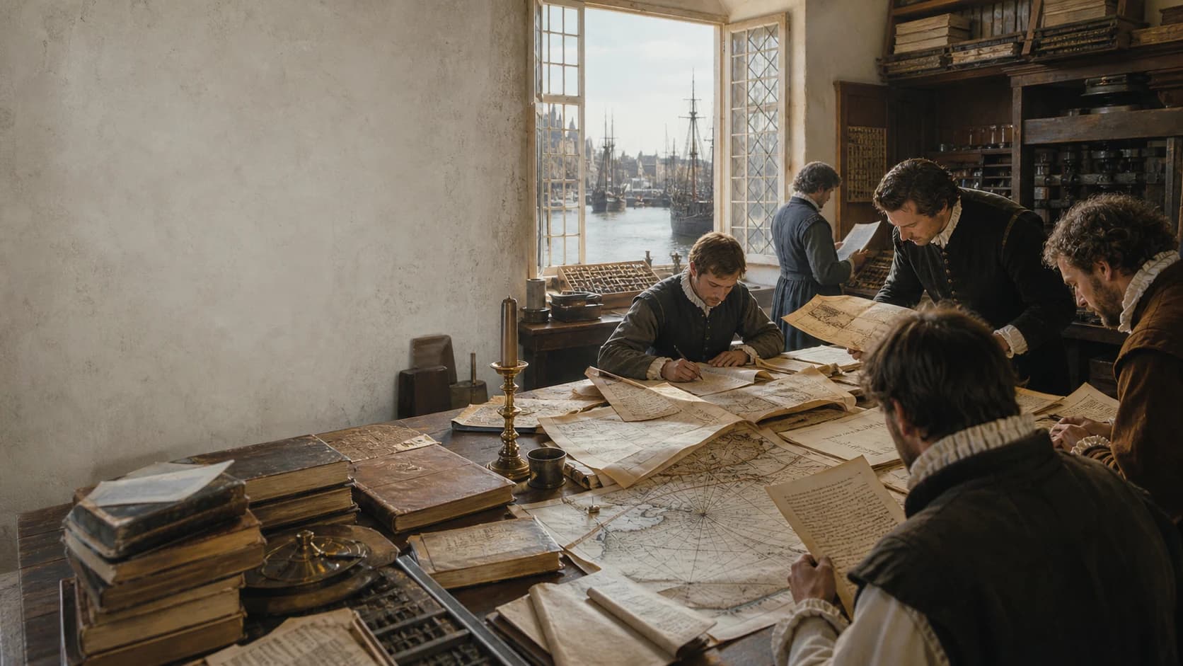
Archive index ↓
The work in view
A vast editorial project turns hundreds of voyage papers into national history.
The Principal Navigations, Voyages, Traffiques and Discoveries of the English Nation is Richard Hakluyt’s vast documentary collection of English travel. A single-volume first edition appeared in 1589; the redesigned edition of 1598–1600 filled three volumes and arranged voyage narratives, merchants’ journeys, private letters, royal patents, company instructions, diplomatic reports, and older chronicles across northern, southern, and American geographies. Hakluyt gathered papers from captains, merchants, diplomats, trading companies, private desks, and printed books in several languages, then titled, translated, excerpted, and ordered them. Failed Arctic expeditions, Muscovy trade, Mediterranean and Asian routes, Hawkins’s slave-trading voyages, Roanoke colonization, and Drake’s circumnavigation consequently entered a shared history of the “English nation.” Success and disaster possess equal archival density: wreck, hunger, and disappearance become warnings for later fleets, while commodities, currencies, tides, and port institutions become reusable commercial intelligence. “Traffiques” names trade and intercourse. The enlarged edition represents a decade of new collecting and a major reconstruction of the national archive. Its pages preserve many texts that might have vanished and reveal how late-sixteenth-century England used print to give overseas expansion a history, a body of knowledge, and a programme for action.
Classic passages
Six document drawers show an archive being made, used, and marked by violence and failure.
- FILE 01A map opens the archiveDedication to the 1589 edition
I found lying open vpon his boord certeine bookes of Cosmographie, with an vniuersall Mappe: he seeing me somewhat curious in the view therof, began to instruct my ignorance.
Plain readingI found several books of cosmography and a universal map lying open on his table; seeing my curiosity, he began to instruct my ignorance.
Hakluyt recalls visiting the chamber of his older namesake and cousin. The map opens connections among seas, commodities, languages, and books. - FILE 02Making a common recordOrdinances for the northeast fleet of 1553 · item 7
The merchants, and other skillful persons in writing, shal daily write, describe, and put in memorie the Nauigation of euery day and night … to put the same into a common leger, to remain of record for the company.
Plain readingMerchants and others skilled in writing were to record every day and night of navigation, compare the ships’ observations each week, and enter an agreed account in a common ledger for the company.
The collection preserves both reports and a method for producing them: distributed observation, regular comparison, and a corporate master record. The ellipsis marks an excerpt. - FILE 03Readable after returnInstructions to Bassendine, Woodcock, and Browne · 1578
Take with you paper and ynke, and keepe a continuall iournall or remembrance day by day, of all such things as shall fall out worth the knowledge … that it may be shewed and read at your returne.
Plain readingTake paper and ink and keep a continuous day-by-day journal of everything worth knowing, omitting nothing, so that it can be shown and read when you return.
Observation becomes reusable knowledge only when it reaches a portable, reviewable page. The document is dated 1588 in the text, though the expedition is generally placed in 1578. - FILE 04Capture and slave tradingAccount of Hawkins’s third voyage · 1567–1569
Our Generall landed certaine of our men … seeking to take some Negros … and so afterward passing the time vpon the coast of Guinea … we obteined by that time the number of 150. Negros.
Plain readingThe commander landed about 160 men in order to capture Africans; after remaining on the Guinea coast, the expedition had obtained 150 people.
The narrative counts captives as things ‘obtained’ and records a sequence of armed landing, capture, transport, and sale. Route and slave trade occupy the same page. - FILE 05As near to heaven at seaEdward Hayes on Gilbert’s voyage · 1583
We are as neere to heauen by sea as by land. Reiterating the same speech … The same Monday night … the Frigat was deuoured and swallowed vp of the Sea.
Plain reading‘We are as near to heaven by sea as by land,’ he repeated; that same Monday night the small vessel was devoured and swallowed by the sea.
Hayes places Gilbert’s last reported words beside the extinction of the ship’s lights. Failure occupies a central place in English voyaging knowledge. - FILE 06A Bengal market networkRalph Fitch’s eastern journey · 1583–1591
Here in Bengala they haue euery day in one place or other a great market which they call Chandeau … many great boats … go from place to place and buy Rice and many other things.
Plain readingIn Bengal a large market called a chandeau was held somewhere every day, and great boats moved from place to place to buy rice and many other goods.
Fitch watches markets, boat capacity, and flows of goods. Hakluyt’s navigation reaches beyond the Atlantic into long-established Asian riverine and maritime systems.
Editor × company × book
From Oxford map lectures to three printed volumes, the archive took two decades of gathering and rearrangement.
- 01
Hakluyt is born
Early sources support a date around 1552. He was educated at Westminster School and Christ Church, Oxford.
- 02
Oxford degrees
Hakluyt took BA and MA degrees and taught cosmography, maps, and navigational geography, treating geography as a network of texts and instruments.
- 03
Divers Voyages
This smaller collection focused on western and North American routes and already used old voyages, maps, and colonial argument to promote future action.
- 04
The Paris embassy
As chaplain to ambassador Edward Stafford, Hakluyt gained access to French, Spanish, and Portuguese publications, navigators, and diplomatic intelligence.
- 05
Discourse of Western Planting
This manuscript memorandum for Elizabeth I argued the strategic and commercial case for North American settlement, forming another strand of Hakluyt’s work in the same decade.
- 06
One-volume first edition
The title used Navigations, Voiages, and Discoveries. The volume assembled English travel from the Middle Ages to Hakluyt’s present in a broadly geographical order.
- 07
Expanded volume I
A newly designed three-volume edition began with northern and northeastern materials on Russia, the Caspian, Persia, and earlier English maritime history.
- 08
Volume I title page reset
Leaves on the 1596 Cadiz expedition were withdrawn and the title-page date changed from 1598 to 1599. Surviving copies preserve different states.
- 09
Volume II
The collection turned south and east of Gibraltar through the Mediterranean, Africa, the Near East, India, and Southeast Asia.
- 10
Volume III
The American volume included Cabot, Frobisher, Davis, Gilbert, Roanoke, and the circumnavigations of Drake and Cavendish.
- 11
East India Company chartered
The company and volume III appeared in the same year. The collection’s accumulated routes, commodities, and port knowledge formed part of this expanding commercial world.
- 12
Hakluyt dies
He was buried in Westminster Abbey. Samuel Purchas and others continued to use papers and editorial networks associated with his work.
- 13
The Hakluyt Society founded
Named for him, the Society publishes annotated primary accounts of travel and has advanced bibliographical study of the Principal Navigations.
Three-volume archive
North and northeast, south and southeast, the Americas: three volumes unfold three documentary geographies.
ARCHIVE CABINET 01
North and northeast
The first expanded volume connects older English maritime precedent, Arctic routes, and Russia–Persia trade along a northern archival axis.- 01
Medieval movement by sea
Ancient and medieval travel, trade, and navigational precedent
- 02
The North Sea and Iceland
Fisheries, islands, and older northern routes
- 03
Willoughby and Chancellor
The 1553 northeast passage expedition and Muscovy contact
- 04
Muscovy Company papers
Company ordinances, merchants’ letters, and observations of Russia
- 05
The Caspian and Persia
Jenkinson and the commercial intelligence of combined land-sea routes
- 06
The Spanish Armada
The northern volume closes on the national war of 1588
ARCHIVE CABINET 02
South and southeast
The second volume crosses Gibraltar and places pilgrimage, diplomacy, commerce, capture, and long-distance travel beside one another, ending in Asia.- 01
Mediterranean and Levant
Venice, Ottoman ports, and merchant-consular networks
- 02
The West African coast
Gold, ivory, textile exchange, and armed conflict
- 03
Hawkins’s voyages
Early records of English transatlantic slave trading
- 04
Red Sea and Persian Gulf
Routes through Aleppo, Basra, Hormuz, and Goa
- 05
Ralph Fitch
Merchant observations of India, Bengal, Burma, and Malacca
- 06
Trials towards the East Indies
Lancaster and English entry into routes dominated by Portugal
ARCHIVE CABINET 03
The Americas and circumnavigation
The third volume orders the western Atlantic by latitude and colonial interest, then places two circuits of the world inside an English maritime history.- 01
The Cabot voyages
Early records supporting English claims in North America
- 02
Frobisher and Davis
Northwest passages, Arctic encounters, and repeated failure
- 03
Gilbert and Newfoundland
Colonial possession, shipwreck, and unfinished design
- 04
The Roanoke papers
Patents, reports, lists, and the lost colony
- 05
Caribbean and Spanish America
Trade, privateering, captive testimony, and enemy intelligence
- 06
Drake and Cavendish
Two circumnavigations within Pacific warfare and exchange
The editor’s position
Ships crossed many seas; their papers converged on one desk.
Hakluyt’s maritime career unfolded across a documentary network: Oxford libraries, the Paris embassy, London trading companies, captains’ private papers, royal records, and printed books in several languages. He found documents and asked living participants to remember, copy, translate, and surrender them.
Each document underwent fresh work at the desk. Hakluyt supplied titles and marginal notes, excerpted long works, translated foreign texts, and ordered materials by geography and national purpose. First-person testimony consequently acquired a new setting, shaped by inclusion and sequence.
That desk gave a second life to commercial letters, failed expeditions, and oral testimony. Within a single volume, pre-voyage instruction produces the shipboard log, the return report enters print, and printed experience supports renewed investment.
The record-making chain
Written instructions and returning papers make observation comparable.
Ordinances for the northeast fleet required merchants and literate crew to record course, landmarks, tides, solar altitude, moon, and stars each day. Observations from separate ships were to be compared weekly and entered in the company’s common ledger. Voyaging knowledge was designed as a collective asset.
Another instruction says it even more plainly: carry paper and ink, write every day, and make the result readable on return. Soundings, seabed, current, coastline, commodities, and reports from local people were all recoverable information. When a vessel failed to return, the instruction could become almost the only surviving outline of its work.
The wharf image condenses this recurring route from voyage to manuscript to archive. Cargo enters a warehouse while a journal enters an editorial network. Commercial return and navigational knowledge complete their handover in the same place, shaping the next departure.
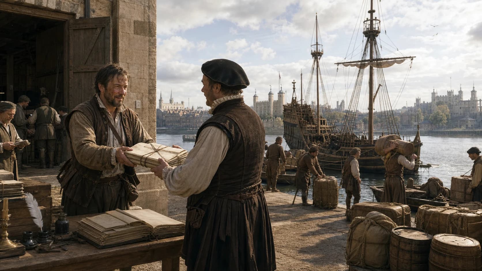
Paper, return, handover, copying, and print carry a voyage into history and pass its observations to the next design.
Actionable geography
Commodities, sailing seasons, languages, and port institutions sit closer to the core than marvels.
In the title, Traffiques means trade and intercourse. Accounts ask where English cloth might sell, where spices or metals originated, how measures and currencies converted, which ruler controlled passage, what language mediation was needed, and which wind or river carried goods onward. Geography is made into a technology for reducing uncertainty.
Ralph Fitch moved from the Levant through Hormuz, Goa, Mughal India, and Bengal to Southeast Asia. Portuguese positions, Indian cities, Bengali river craft, and Southeast Asian markets already formed a connected world. Hakluyt included the journey as a route into those established networks.
Ships and storms supply narrative drama, while days, depth, cargo, taxes, and provisions form the practical skeleton. Adventure and commercial intelligence remain superimposed, allowing one voyage to function as story, market survey, and risk record.
People entered as numbers
The same archive turns capture, slave trading, and colonial occupation into calculable projects.
The Hawkins narrative advances by fleets, casualties, and numbers, counting captured Africans among the things ‘obtained’, carried across the Atlantic, and sold in Spanish colonies. Its sequence is explicit: armed landing parties sought captives, attacked settlements, and transported people for sale.
The North American papers place patents, promotional descriptions, resource lists, and settlers’ names together. Roanoke’s history emerges from pages with different purposes and significant gaps: planning, settlement, and disappearance each leave a different kind of record.
Hakluyt’s national frame gives English overseas action historical depth and apparent common direction. It preserves evidence while organizing desire: trade, mission, rivalry, and possession are aligned as a history that can be continued.
Breaks in the file
Extinguished lights, missing ships, and an unanswered colony draw a different map.
Gilbert’s small ship lost its lights suddenly in a storm north of the Azores. Hayes preserves reported last words and a witness’s inference, then the narrative breaks with the light. The bodies and papers of Willoughby’s Arctic fleet and the lists and vacant site of Roanoke create comparable archival fractures.
Failure continued to serve the collection’s expansionist purpose. Hull size, the position of ice, the moment provisions failed, and the chain of command became instructions for another attempt. Mourning and technical revision occupy the same page.
African captives, Indigenous Americans, Asian port residents, and ordinary sailors usually appear through English or European narrators. Their actions, resistance, and exchanges leave indirect traces whose form remains shaped by the identity and purpose of the recorder.
The edition is evidence
1589 and 1598–1600 differ by more than thickness.
The first edition was a single large volume; the expansion issued a decade later became three volumes with a transformed quantity, geography, and national argument. The addition of Traffiques to Navigations, Voiages, and Discoveries in the title gives commercial exchange greater visibility.
Volume I once included an account of the 1596 Cadiz expedition, then lost those leaves and received a reset title page. A Wright–Molyneux world map intended for volume II survives in a small number of copies. Individual sets consequently carry different leaves, map configurations, and title-page dates.
A digital facsimile reveals the book as a material object. Project Gutenberg’s searchable fourteen-part text derives from Goldsmid’s 1885–90 setting, while modern selections provide annotation and a shorter reading path. Original pages, searchable wording, and scholarly guidance serve distinct purposes.
Archive construction
Preservation, editorial intervention, national viewpoint, and silence build the archive together.
How England gathered navigational knowledge
Instructions, logs, letters, reports, and editorial notes expose the path of information from ships to companies and printers.
First-person testimony carries several stages of handling
Many items have named authors; copying, translation, excerpting, titling, and placement give their testimony a new editorial setting.
Indirect traces of colonized and enslaved people
European narrators hold most of the writing power, while local action, resistance, and language enter through report and fragment.
Every set has its own assembly history
Cadiz leaves, reset title pages, and the Wright–Molyneux map vary among copies. Volume, page, edition, and holding copy locate each citation.
Reading editions
Original pages, searchable wording, and modern selections offer three reading paths.
Library of Congress · expanded edition in three volumes
Page images preserve original setting, title pages, and volume structure. The Wright–Molyneux map is absent from this holding copy.
E. Goldsmid setting · Project Gutenberg
Fourteen searchable text files preserve much early spelling and embody a nineteenth-century system of transcription and resetting.
MacLehose edition in twelve volumes
A classic library reprint with indexes, useful for sustained reading of the expanded text. Its own pagination accompanies the original folio references.
Voyages and Discoveries · edited by Jack Beeching
A manageable English selection and a strong first encounter, with the complete three-volume collection available for deeper textual and bibliographical work.
Reader questions
Editor, three volumes, traffiques, colonial history, slave trading, and online text.
Who wrote The Principal Navigations?+
The title page names Richard Hakluyt. His central role was editorial: he found, copied, translated, excerpted, titled, and arranged voyage narratives, letters, instructions, and older records by many writers.
When was The Principal Navigations first published?+
The one-volume first edition appeared in 1589. A greatly expanded three-volume edition followed in 1598–1600; some copies of volume I have a 1599 title page after the removal of Cadiz material.
What does each volume contain?+
Volume I focuses on northern and northeastern routes, Russia, and Persia; volume II turns south and east of Gibraltar through Africa, the Mediterranean, and Asia; volume III collects the Americas and the circumnavigations of Drake and Cavendish.
What does ‘traffiques’ mean in the title?+
In sixteenth-century usage it means trade, commerce, and intercourse. Its addition to the expanded title foregrounds the collection’s commercial purpose.
How did Hakluyt obtain voyage material?+
He built networks in Oxford, Paris, and London and obtained papers from travellers, captains, merchants, diplomats, trading companies, and foreign-language print.
Why is the book important to colonial history?+
It combines patents, promotional argument, resource lists, settler names, and Anglo-Spanish rivalry within a continuous national past, helping make overseas expansion appear inherited and repeatable.
Does it document English slave trading?+
Yes. Accounts of Hawkins’s voyages explicitly record armed capture on the West African coast and the transport and sale of captives in the Americas. They are central sources for early English participation in the transatlantic slave trade.
Where can I read it online?+
The Library of Congress provides page images of the expanded edition. Project Gutenberg offers searchable text derived from the fourteen-part Goldsmid edition. Use the former for original pages and the latter for finding words and passages.
Research sources
Original copies, copy census, editorial method, and national frame
- 01The Principal Navigations, Voiages, Traffiques and Discoveries · 1599–1600 ↗
Library of Congress
Original page images, bibliographical record, volume scope, and map note - 02Richard Hakluyt’s Navigations ↗
The Hakluyt Society
Overview of the 1589 and 1598–1600 editions and the Cadiz leaves - 03Richard Hakluyt: a bibliography, 1580–1588 ↗
The Hakluyt Society
Bibliography of early publications, translations, and the Paris network - 04Richard Hakluyt and Oxford Geography ↗
Journal of the Hakluyt Society
Oxford lectures, the 1589 dedication, and Hakluyt’s geographical education - 05The ‘Suppression’ of the Cadiz Voyage ↗
Journal of the Hakluyt Society
Detailed study of the withdrawn Cadiz leaves and their political setting - 06Census of Hakluyt’s Principal Navigations, 1598/9–1600 ↗
The Hakluyt Society
Copy census recording Cadiz leaves and the Wright–Molyneux map - 07How to read Hakluyt’s Principal Navigations ↗
The Hakluyt Society Blog
Guide to the geographical structure of the three volumes - 08Editing Hakluyt’s The Principal Navigations ↗
The Hakluyt Society Blog
Problems of choosing between the 1589 and expanded texts - 09Works by Richard Hakluyt ↗
Project Gutenberg
Searchable Goldsmid text in fourteen parts and other works - 10The Principal Navigations: online editions ↗
University of Pennsylvania Libraries
Navigation among digitized volumes and text editions
Sources checked and page updated 25 August 2026. Read our editorial and citation standards