INPUT
→Receive and register evidence
Record log, sketch, old edition, author, date, route and secrecy.
A real Age of Sail career dossier · 33
Cartographer · Chartmaker · Mapmaker
The specialist who forced conflicting voyage evidence onto one scale and decided which lines a captain might trust.
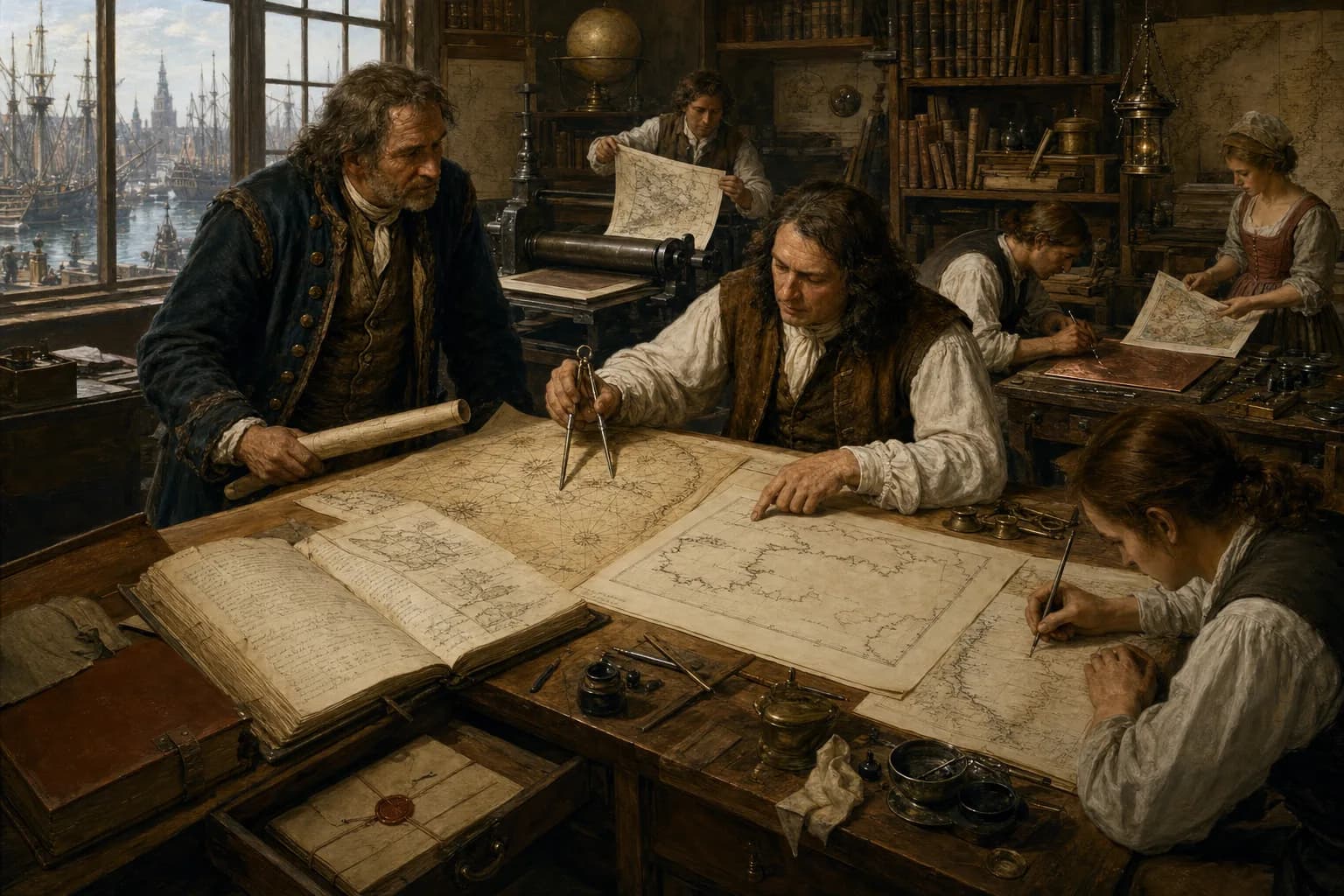
An Age of Sail cartographer or chartmaker did not normally have to sail every coast represented. Ashore, the maker received captains' logs, rutters or pilot books, harbour sketches, compass bearings, latitude observations, soundings, coastal profiles, older charts and sometimes captured foreign material. Sources were dated, compared for dependence and judged for reliability before scale, projection, orientation, names and symbols were reconciled into a manuscript chart or an approved drawing. An engraver reversed that drawing onto copper; printer, colourist, binder, publisher and seller carried it into circulation. The sea surveyor or hydrographer gathered primary coastal bearings, depths, tides and views in the field. Champlain, Cook and Des Barres combined survey, voyage and cartography, but their composite careers should not stand for every mapmaker. A chart was no transparent copy of discovery: difficult longitude, conflicting evidence, reused plates, secrecy, cost and imperial naming all entered the image. The cartographer's distinctive skill was turning incompatible evidence of unequal quality into a working chart whose scale, scope and uncertainty could be understood.
Information arrives, judgment forms, and work passes on through a complete watch.
Record log, sketch, old edition, author, date, route and secrecy.
Compare dependence, then choose latitude, distance, controls, scale and projection.
Produce working and fair drafts; check coast, depth, name, sign and blank.
Approve reversed plate and proof, then absorb annotation, new survey and casualty report.
Centered parchment, copied portolans, commissioned atlases, multi-hand fair drawing and decoration.
Centered copperplates, proofs, editions, atlas stock, instrument trade and inter-port sales.
Received confidential returns and maintained master charts, standard signs, approval and limited issue.
Identify date, author, direct observation and copying relationships across logs, rutters, sketches and old charts.
Reconcile latitude, distance, scale, orientation and projection while managing distortion.
Select coast, soundings, shoals, anchorages, profiles, names, roses and legends.
Check fair copy and proofs, register corrections and choose alteration, recutting, recall or explicit doubt.
Institutions, experience, patronage, and opportunity shaped each person’s route.
Begin with ink, paper, tracing, lettering, colour and shop stock.
Independently fair-copy, engrave a section, convert scale and compare evidence.
Own evidence choice, graphic consistency and correction for a chart.
Control source network, plate capital, workshop labour, patronage and edition liability.
The Library of Congress introduces Samuel de Champlain by noting that most charts were drawn by professional cartographers from information supplied by explorers, navigators and cosmographers. Champlain was exceptional because he charted from his own observation, interviews, mathematics and exploration. That exception marks the boundary: compilation and graphic construction defined the cartographer, not presence in every sounding boat.
A London, Amsterdam, Venetian or official chart room might be thousands of miles from the coast depicted. Returning captains, pilots, merchants, naval officers, colonial officials or captured ship papers delivered new material. The maker asked who drew it, when, whether it was observed directly and whether several reports copied one ancestor. Some chartmakers certainly sailed, and some posts required it, but chartmaking itself did not require personal attendance along every shore.
A source desk could hold daily latitude, course and estimated distance from a log; verbal landfalls from a pilot book; harbour sketches; soundings, currents and seabed notes; and earlier manuscript or printed charts. Coast, danger, name and longitude often disagreed. The same error might appear to win a vote because several charts had silently copied one another.
William Hacke makes the compiling labour unusually visible. After a long apprenticeship in the Thames School, he remade Spanish South Sea waggoners captured by Bartholomew Sharp's privateers as English manuscript charts, adding anchorages, distances, rivers and navigation information. Geographic evidence could therefore arrive through open survey, confidential office, trade network, wartime seizure and translation; provenance was itself valuable property.
A hydrographer or sea surveyor planned survey lines, took angles and soundings from shore stations and boats, observed tide and landform, then supplied field books, fair sheets or remarks. The cartographer reconciled these with inherited evidence and chose projection, scale, extent, symbols and names. An engraver cut the approved drawing in reverse into copper. Printer, colourist, binder, publisher and bookseller turned the plate into a circulating sheet or atlas.
Real businesses overlapped identities. Willem Blaeu made globes and navigation instruments, published maps and charts and became VOC mapmaker in 1633; John Seller was instrument maker, chart seller and Hydrographer to the King. Yet a firm spanning stages did not make the acts identical. Ask whether a person collected primary observation, decided content, cut a plate, or owned plates, capital and distribution.
Surviving portolan charts emerge after the late thirteenth century from Mediterranean sailing directions and accumulated coastal practice. Drawn on vellum or parchment, they emphasized coasts, harbours, islands, place names and a rhumb-line network radiating from multiple centres. Interiors might remain bare or carry flags and figures. The lines organized legs by compass direction; they did not turn the sheet into a modern conformal route map.
Fine manuscript atlases were often workshop products. Battista Agnese ran a substantial Venetian operation represented by many surviving sixteenth-century atlases. Royal Museums Greenwich likewise identifies multiple hands through handwriting, finish and volume. A master might control sources, layout and key lines while assistants prepared parchment, traced, lettered, coloured, gilded and bound. The product could be working instrument, diplomatic gift, status object or collection piece.
The maker established usable control from stronger latitudes, ports and headlands, measured baselines or voyage distances, then converted sources to a common scale. Celestial altitude could yield latitude with some regularity in the sixteenth to eighteenth centuries, while longitude remained far harder before reliable marine chronometers. East-west disagreement between sources could therefore be severe. Mercator's projection made a constant compass course straight but distorted scale with latitude and was never the only chart form.
Content choices included generalized coast, soundings, shoals, rocks, anchorages, seabed, tide remarks, coastal profiles, settlements, forts, names, latitude scales, compass roses and legends. Every precise-looking numeral asserted confidence. Strong practice distinguished direct survey, credible report, copied tradition and conjecture; weak practice multiplied a handsome false coastline into many downstream decisions.
At Spain's Casa de la Contratación, official cosmographers interpreted observations from Crown-sponsored voyages; the VOC employed official mapmakers. Chart room, master chart, survey return and copperplate could all be protected by privilege, oath or limited issue because a safe route, an unpublished harbour or one shoal changed commerce and war. Hacke's repackaging of captured Spanish knowledge shows secrecy crossing a hostile frontier.
Maps also made authority appear geographic. Arms, colonial limits, possessive names, forts, routes and blank space shaped how readers saw a sea. Diego Gutiérrez and Antwerp engraver Hieronymus Cock joined Spanish official geography, northern print skill and imperial claim in the 1562 map of America. However its ethics were phrased, the trade always balanced what a patron wanted displayed, what a navigator needed and what evidence could bear.
An approved fair drawing went to an engraver, who cut coast, reversed lettering, soundings, hatching, cartouche and scales into copper. The printer filled the incisions with ink, wiped the surface and drove damp paper through a rolling press. Cartographer or publisher marked missing lines, reversed letters and bad numbers on the proof; the plate was burnished, re-engraved or supplemented before colour, blue backing, trimming and binding.
A finished plate represented capital. Publishers bought, inherited and shared plates, or changed a date and selected details on old copper. John Seller's English Pilot, begun in 1671, passed through other hands, while Mount & Page and successors sold the series for more than a century. Print made one chart spread quickly; it did not make evidence current, and the economics of plate and inventory could preserve an obsolete coast.
Working charts acquired salt, folds, pencilled courses, new soundings, renamed headlands and warnings. A dependable shop or hydrographic office had to identify editions, register corrections and return dated evidence to a manuscript master or copperplate. Eighteenth-century projects such as the Atlantic Neptune joined systematic coastal surveys, charts and views, showing a navy's growing need for a traceable survey-to-publication chain.
Britain's Admiralty Hydrographic Office was not founded until 1795, and its first official chart appeared in 1800, so nineteenth-century continuous correction cannot be projected backwards across the Age of Sail. The UK National Archives notes that early official sheets might still rest on surveys a century old, that copperplates were modified and reissued, and that obsolete charts endangered navigation. The useful game loop is not unlocking a perfect map but deciding whether to trust a report, pay for alteration, recall stock and mark doubt.
Entry might be apprenticeship to a chartmaker, engraver, instrument maker, stationer or bookseller. Beginners ground ink, prepared paper and parchment, traced coasts, copied names and drew scales and roses before learning geometry, projection, latitude calculation, source collation and proof correction. A journeyman could fair-copy or engrave independently; a master needed networks of captains and surveyors, plate capital, official patronage and liability for error and deadline.
Income came from manuscript commission, sheet and atlas sale, piece-rate engraving, publishing partnership, official salary or monopoly privilege. Royal Museums Greenwich research identifies women as surveyors, compilers, engravers, publishers and sellers in London's chart trade; widows and daughters could inherit shops, plates and customers. An imprint often privileged master, publisher or patron and should not be mistaken for the whole workforce.
career.cartographer
Some did, especially when also explorers, navigators, sea surveyors or naval officers. Most professional cartographers, however, could compile charts ashore from logs, survey returns, older maps and reported knowledge.
A hydrographer or sea surveyor chiefly gathered coastal positions, soundings, tides and views in the field. A cartographer reconciled evidence, projection, scale and graphic content. One person or office could combine both.
They used latitude observations, compass bearings, estimated courses and distances, soundings, coastal baselines, harbour sketches, logs and inherited charts. Longitude remained harder, so east-west disagreement was common.
After the cartographer approved a fair drawing, an engraver cut it in reverse into copper. A printer inked, wiped and pressed proofs; correction, printing, colour, backing, binding and sale followed.
Sparse survey, copied sources, expensive plates, inherited copper, secrecy and inventory cost delayed correction. Printing increased replication, not accuracy by itself.
Yes. Museum research identifies women surveyors, compilers, engravers, publishers and sellers, as well as heirs to family shops, although imprints obscure much collaborative labour.